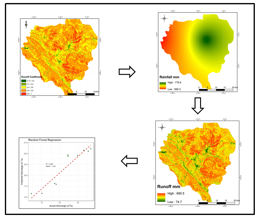
The assessment of surface runoff is a superficial, complex, and sensitive topic, and its changes amidst the challenges of climate change, which this region is not immune to. Especially in the Kurdistan region and throughout Iraq, due to the lack of ground monitoring stations for flow rates, and if they exist, they are old and outdated. The present investigation seeks to evaluate the outflow and the rainfall-runoff process for the Jundian sub-basin. A GIS environment has been employed to alter spatial information in the form of slope, soil type, land cover diagrams, and the runoff coefficient (RC) as a crucial component for the investigation. For obtaining ongoing precipitation data, inverse distance weighted (IDW) extrapolation was performed. The runoff coefficient ranged from low to high (0.12 to 1.00). The highest runoff was observed during 2014 at (23.34 m3/s). During 2009 (12.06 m3/s), the least was produced in the watershed. Random Forest Regression achieved the highest R2 (0.862), lowest RMSE (1.927 m³/s), and highest NSE (0.862), excelling all other models used to relate the ratio between actual and predicted runoff. The study confirms the importance of GIS in storing and processing surface runoff. This is a good step towards investing in water resources, setting future strategies, and opening new horizons for decision-makers.