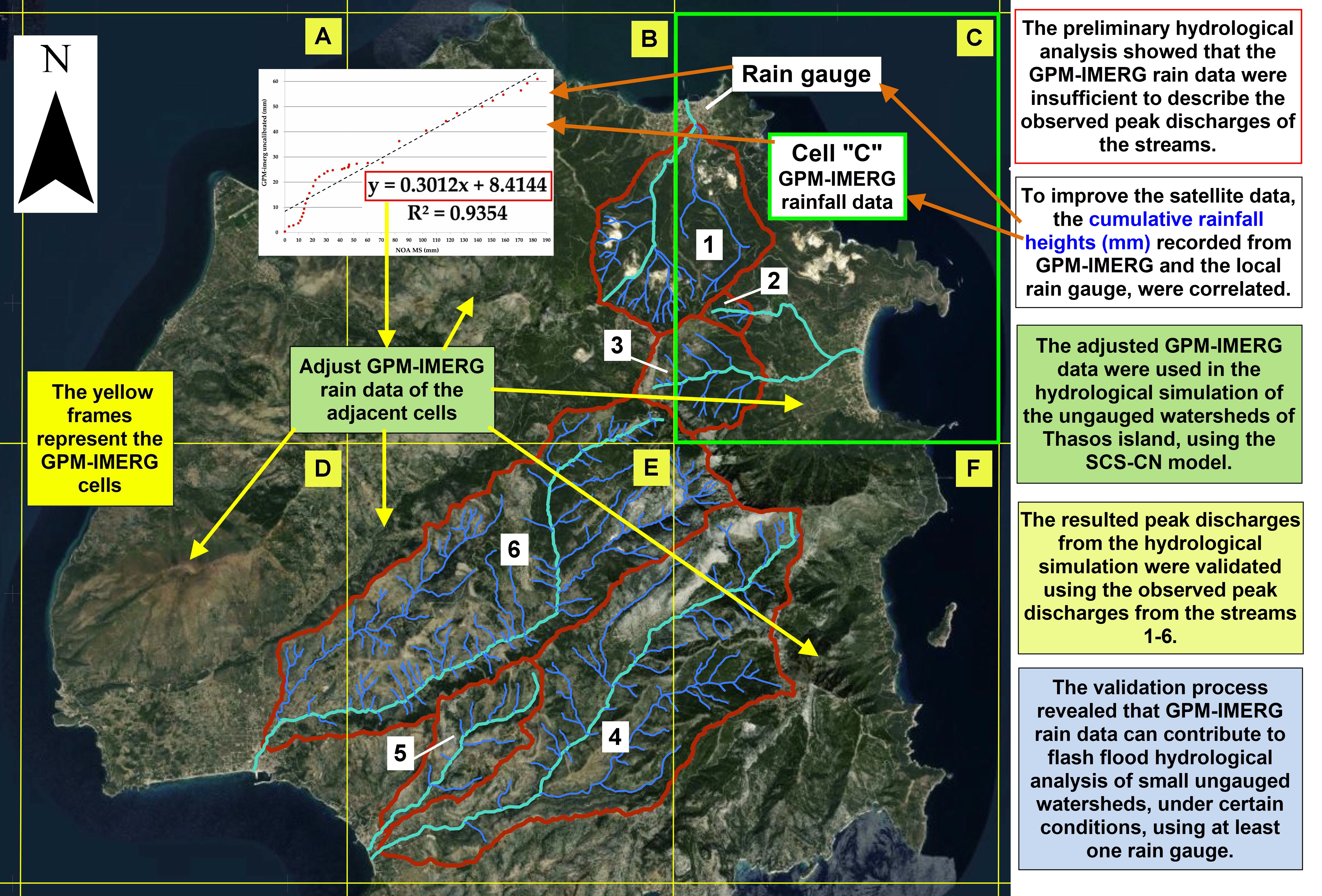
Aim of the study is to examine the potential utilization of satellite precipitation data to estimate the peak discharges of flash floods in ungauged Mediterranean watersheds. Cumulative precipitation heights from local rain gauge and the GPM-IMERG were correlated in a scatter plot. The calculated linear equations were used to adjust the uncalibrated GPM-IMERG precipitation data in Thasos island (Northern Greece), to investigate the mechanisms of the flash floods recorded in November 2019 and to evaluate the significance of satellite precipitation data in hydrological modeling. The uncalibrated GPM-IMERG precipitation failed to explain the flash floods phenomena. The rain gauge data are reliable to accurately predict the peak discharges only in cases, where the rain gauges are within the study area. The strong correlation between ground rainfall data and satellite spatiotemporal precipitation data (R2 > 0.65), provides linear regression equations that, through their extrapolation and appliance to the rest of the flooded area, could adjust and correct the satellite data, optimizing the efficiency and accuracy of flash flood analysis, especially in ungauged watersheds. The proposed methodology could highly contribute to the optimization of flood mitigation measures establishment, flood risk assessment, hydrological and hydraulic simulation of flash flood events in ungauged watersheds.