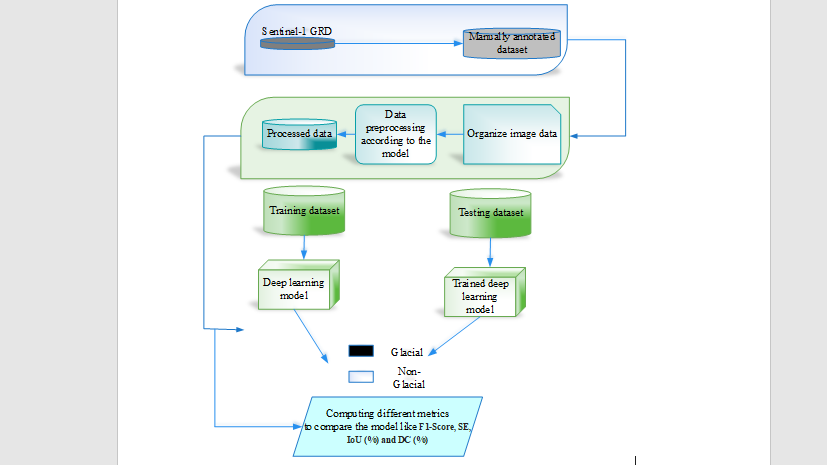
A crucial component of the cryosphere in the the Karakoram range of mountains are glacier lakes. Glacial lake outbursts floods (GLOFs) pose a short-term hazard to downstream communities and ecosystems due to rising temperatures caused by climate change. As a result, monitoring GLOF dangers requires the use of the Glacial Lake map method. Data from the Sentinel-1 Ground Range Detected (GRD) microwave mission were used in this analysis. Regardless of the weather or cloud cover, it can penetrate and use dual polarization (HH + HV or VV + VH). The purpose of this research is to examine how algorithms based on machine learning may be used to extract water bodies from GRD data and how effective they are. Supervised Machine Learning classifiers and GRD backscattering analysis form the backbone of the research methodology. Common deep learning methods include FCN, U-Net, U-Net++, and others. The suggested Residual Attention U-Net++ model in this research makes use of both extraction maps and attention maps. In the research region, both approaches provide superior results for mapping glacial lakes. However, when it comes to total backscattering analysis, the mean backscatter parameter has the greatest accuracy rate. The classification method also included comparing each classifier's output to the reference data to determine its correctness. In order to ascertain the brief flood outburst and implement future preventative measures, the high precision of classification achieved while extracting glacial lakes utilizing our method will prove valuable.