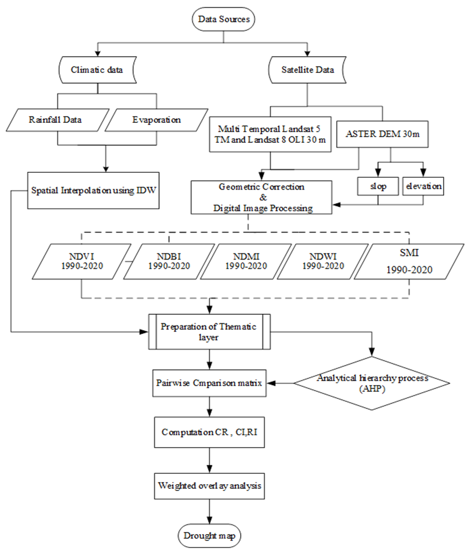
Among all other natural resources, droughts are progressively affecting our communities because to their gradual and sustained evolution over several years. Droughts impact agriculture and result in catastrophic consequences. The present research sought to model the spatial variability and occurrence of drought in Babylon city and its vicinity utilizing GIS and remote sensing through a subjective model, specifically the Analytical Hierarchy Process (AHP), integrated with Geographical Information System (GIS) and various influencing parameters. In this study, 12 parameters, namely elevation, slope(degree), LCLU, land surface temperature (LST), normalized difference moisture index (NDMI), normalized difference building index (NDBI) and soil moisture index (SMI), Annual rainfall (mm), Evaporation, Relative humidity, and SPI. were used to delineate the drought in study area. We employed the QGIS plugin to analyses datasets and evaluate drought prevalence using MCA. The plugin incorporates GIS-based appropriateness analysis and multi-criteria decision analysis, mitigating financial and technological obstacles for analysts and planners in poor countries. The MCDA model's peak performance in the "ideal location" scenario, with a (kappa value = 1), demonstrates its robustness and trustworthiness in identifying drought conditions in the Babylon area. the study classified area into four levels/zones of drought prevalence: mild, moderate, severe, and extreme. The region is highly susceptible to drought, with 55.4% experiencing extreme drought, 16.1% experiencing mild drought, and 3.3% experiencing no drought. Water deficits vary across areas, and 59.57% of the study area falls within the high drought zone.