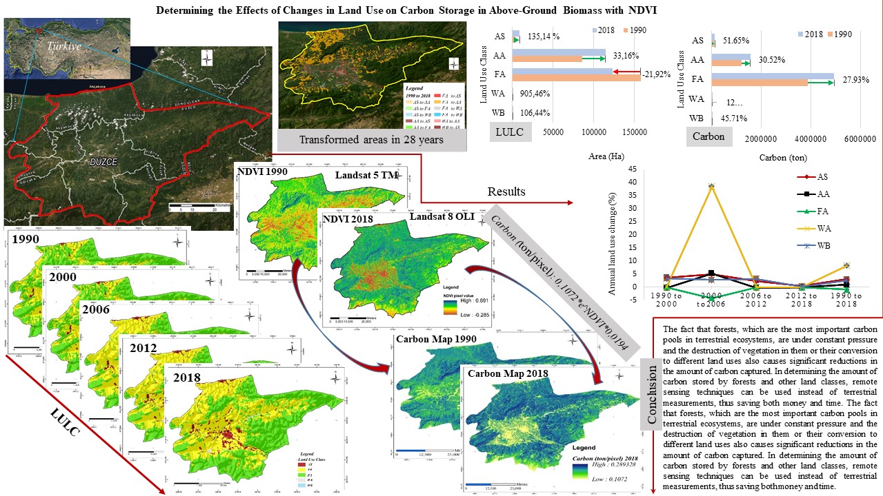
In terms of sustainable land use management, it is extremely important to reveal the land conditions and the changes that occur on the land in certain periods. In this study, using CORINE data for Düzce province, land use status and transitions between land-use classes over 28 years were investigated. In addition, changes in carbon storage in above-ground biomass were determined for each land-use and land transition using Landsat satellite images for the years 1990 and 2018. 28 years, artificial surfaces increased from 3,852 hectares to 9,058 hectares. While agricultural areas increased by 11.5% to 114,650 hectares, forest and semi-natural areas decreased by 14% to 122,955 hectares. 96.7% of the increase in agricultural areas was land converted from forest areas. While the amount of carbon stored in the forest and semi-natural areas increased by 27.9%, it increased by 30.5% in agricultural areas. With land transitions, 17.8% of the total carbon (14,407 tons) was transferred from one land use to another. In terms of annual land-use change rate between 1990 and 2018, the highest rate of land-use change was in the post-earthquake 2000-2006 period. The information in this study will make important contributions to policymakers in land management and planning.
Total file downloads: 13