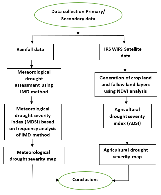
Drought is a disastrous natural phenomenon. It is generally viewed as a sustained and regionally extensive occurrence of below average natural water availability either in the form of rainfall, river runoff or groundwater. Drought is defined based on different factors and generally assessed in meteorological, hydrological and agricultural contexts. Efficient management of drought over an area or catchment depends mainly on its correct assessment. In this study, Meteorological drought severity assessment was carried out based on the frequency analysis of IMD method producing Meteorological Drought Severity Index (MDSI). Agricultural drought severity assessment was carried out by developing an Agricultural Drought Severity Index (ADSI), which involves crop land and fallow land estimation, delineated from remote sensing data using NDVI analysis. The methodology was applied for Samba season (major crop season) of Palar Sub-basin encompassing Vellore (a chronic drought prone district), located in the North-East part of Tamil Nadu State, India. Block-wise drought severity maps were generated using geospatial environment to understand the drought severity status of the area. It is observed that 70% of the blocks in the study area were affected by moderate and severe droughts, which needs drought proofing measures.