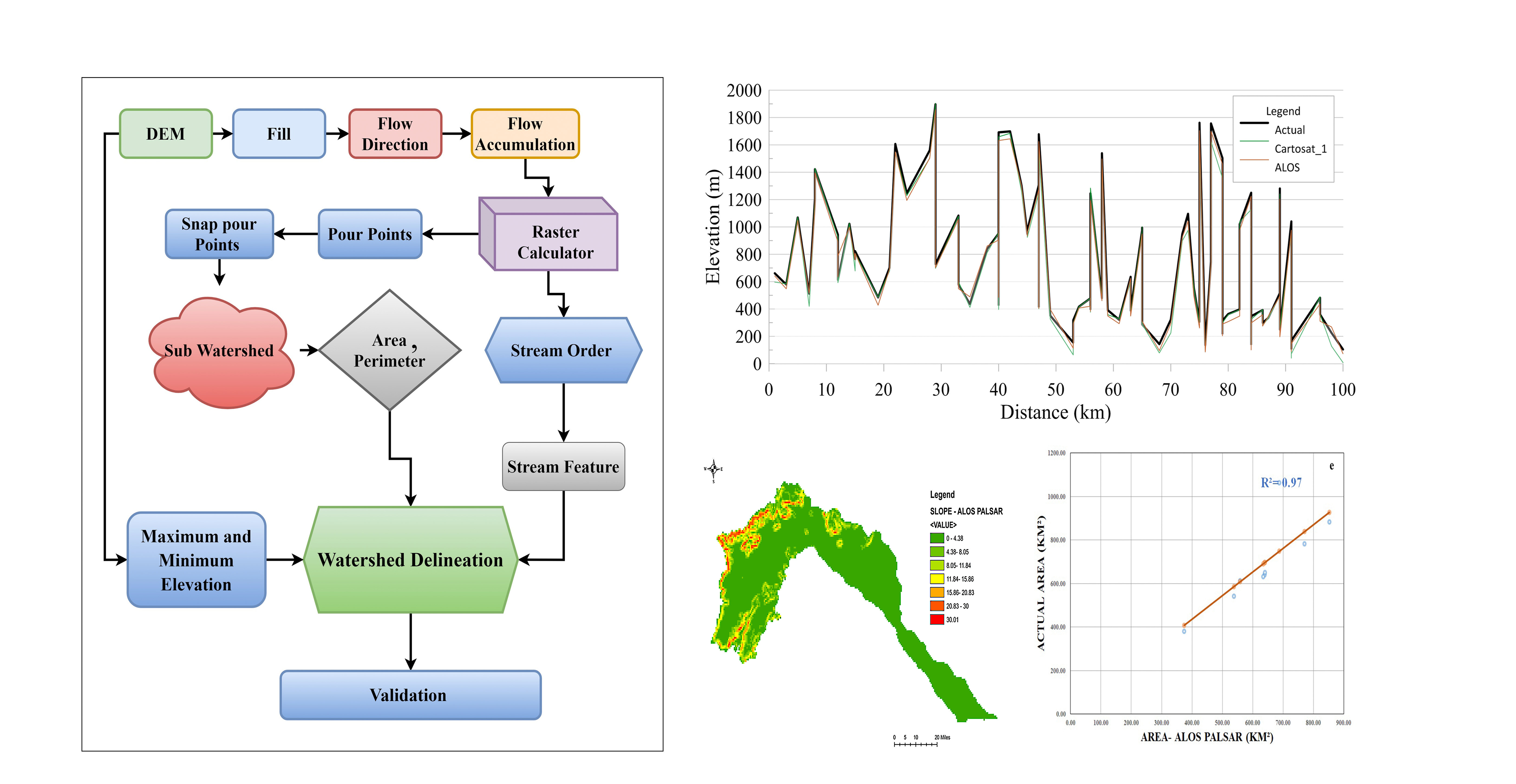
Digital Elevation Model (DEM) is an inevitable tool for many applications, such as natural resource management. In the present scenario, it is available with various resolutions from meter to sub-meter accuracy. These data are used extensively to explore the river basin's physical features by detecting and extracting watershed boundaries, elevation points, drainage networks, flow directions, and morphological parameters. Although many researchers have used DEMs to delineate the watershed boundaries of the river basin, accuracy makes the significant distinction and usage of various DEMs. In this study, the accuracy of watershed delineation derived from various open-source DEMs such as Shuttle Radar Topographic Mission (SRTM), Advanced Spaceborne Thermal Emission, and Reflection Radiometer (ASTER), Cartosat-1, and ALOS Palsar, in the vaigai river basin have been observed. The Arc SWAT hydrological modeling tool was used to delineate the watershed boundary using the DEMs mentioned above. Eventually, the outcome is validated with the help of base data received from TN-PWD (Tamilnadu Public Work Department). The results attained from the extraction of the watershed boundary from various DEMs reveal that the watershed boundary delineated from ALOS – Palsar is closely matching with the actual boundary of vaigai river basin. The regression analysis of the watershed on area and perimeter obtained from the ALOS Palsar DEM yielded R2 as 0.97 and 0.99. This R2 exhibits the close fitness of the predicted value with data obtained from TN-PWD data. The ALOS Palsar DEM provided low vertical errors and high vertical accuracy compared to other DEMs. Overall the ALOS Palsar DEM generated outcome exhibited comparatively better results than the rest of the DEMs.