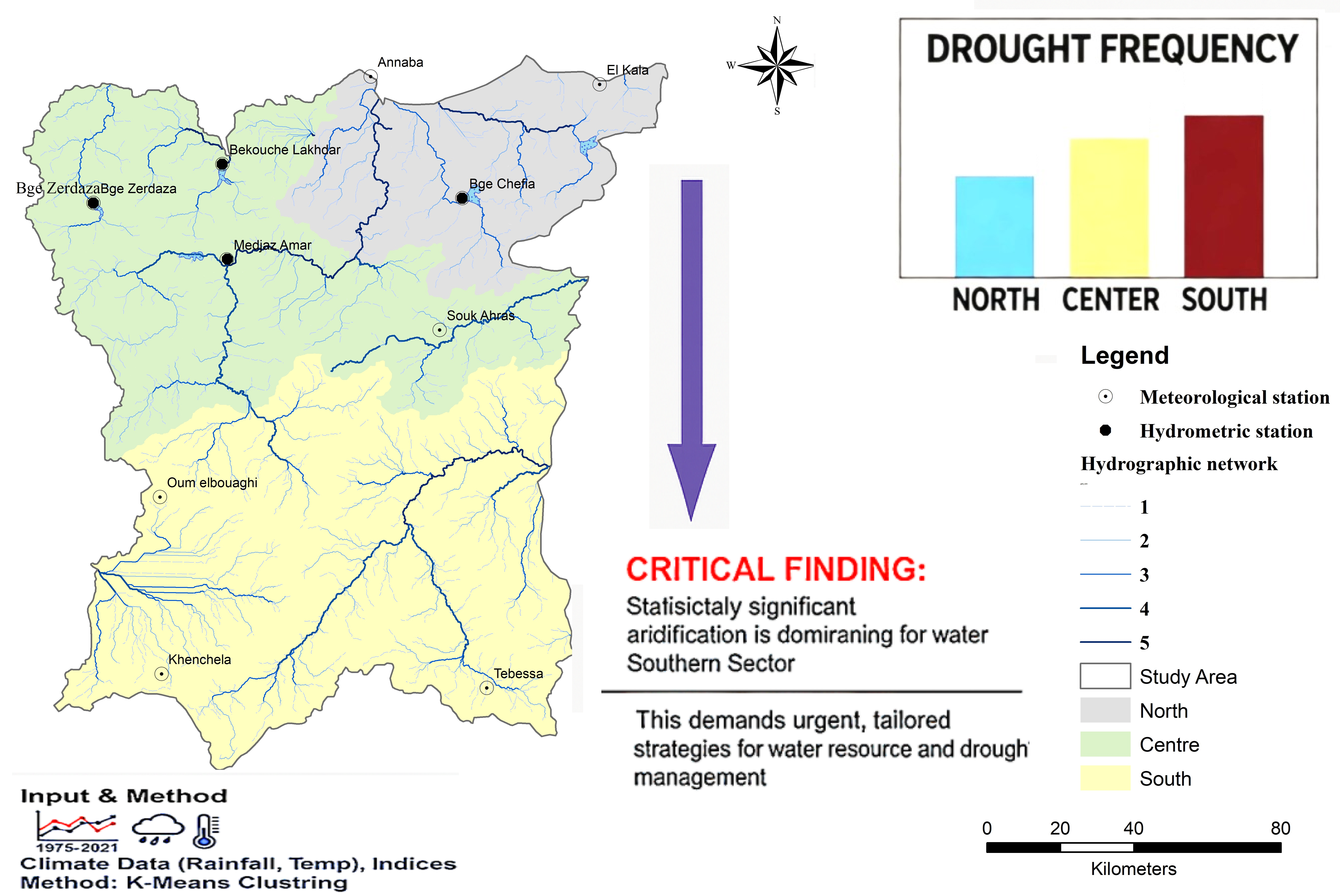
Drought poses significant challenges to water availability, agriculture, and socioeconomic stability in Northeast Algeria. This study delineates the region into North (Mediterranean), Center (semi-arid), and South (arid) sectors using K-Means clustering and assesses drought trends with SPI, RDI, and SDI from 1975–2021. Results indicate near-normal conditions in the North (SPI-mean = 0.00023, RDI-mean = 0.003), transitional drying in the Center (SPI-mean = 0.0007, RDI-mean = 0.0008), and severe aridification in the South (SPI-mean = -0.0004, RDI-mean = -0.0007). Significant drying trends were observed in Oum El Bouaghi (Z = -8.620, p < 0.0001) and Khenchela (Z = -6.357, p < 0.0001). SDI analysis revealed stable streamflow but short-term drought risks at Medjaz Amar and Zerdaza Dam. Strong correlations among indices, particularly RDI with SPI and SDI, highlight the South’s heightened vulnerability. These findings provide critical insights for policymakers to develop targeted drought mitigation strategies, such as enhanced water storage and efficient irrigation systems.