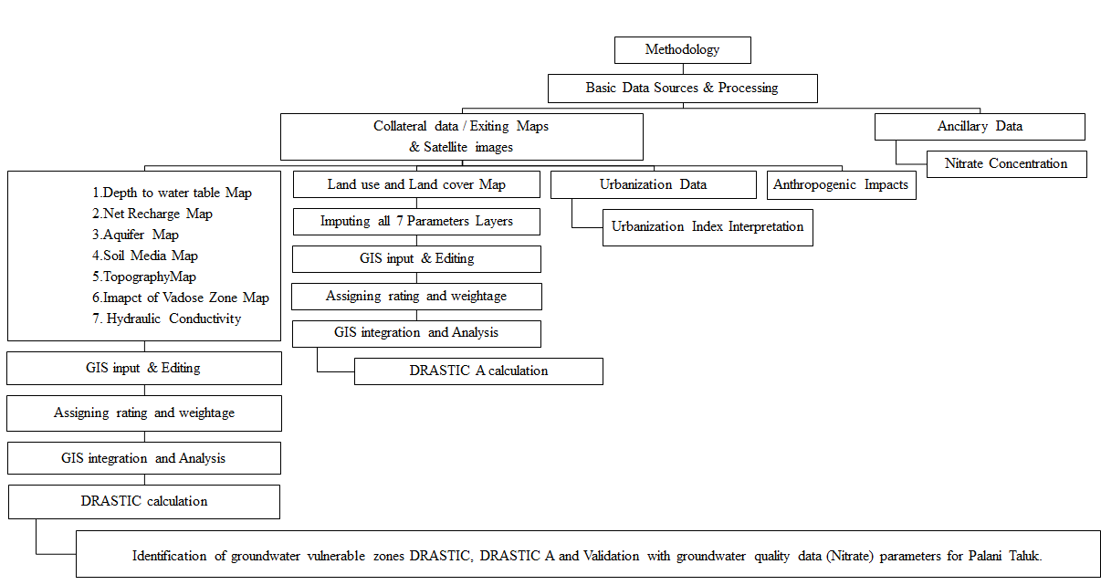
Urbanized areas groundwater vulnerability and contamination are serious issues that require due attention. There are other models, notably the DRASTIC models employed to assess the vulnerability of groundwater. In a modified version of the DRASTIC model known as anthropogenic influence was incorporated into DRASTICA as a model parameter. The research used a cutting-edge methodology to define the anthropogenic employing satellite data of nighttime lighting to have an impact using human settlements as a stand-in and the Palani Taluk's surrounding land use/landcover. The spatial integration of various parameter maps was done using a geographic information system. According to data on groundwater vulnerability to pollution, around 29.98% of the area is in a very high vulnerability zone, followed by 23.68% of area covers high vulnerability, 25.18% comes under the range of moderate vulnerability, 12.14% covers the area in the zones of low vulnerability, and 8.97% area covers the total area in the ranges of very low vulnerability. Utilizing the amount of nitrate in ground water, the findings were confirmed. It was determined that in an urban environment, the suggested DRASTICA model achieved enhanced than the conservative DRASTIC model. The classifications are as follows: extremely high, high, medium, and low. Very high Vulnerability zones account for 214 values in Palani taluk, the research region, whereas very low vulnerability zones account for 3 values in Palani taluk. Urbanization index showed that anthropogenic impact and the depth of the water table had a substantial impact on groundwater susceptibility to contamination, indicating that manmade effect must be carefully taken into consideration in such studies. This study's modified-DRASTIC/DRASTICA model will aid in better classifying groundwater sensitive areas to contamination where manmade pollution is high, especially in and near metropolitan centers. The groundwater susceptibility possible map that is produced can be more successfully used as the main tool for managing, organizing, and safeguarding groundwater resources. Low nitrate concentrations are found in forests and arid terrain, whereas high nitrate values are found in urban areas. The majority of the Palani taluk has low to moderate nitrate concentrations. The Melkaraipatty and Thalaiyuthu Palani Taluk's urban areas are considered by high sensitivity because of low water levels and strong manmade effect.