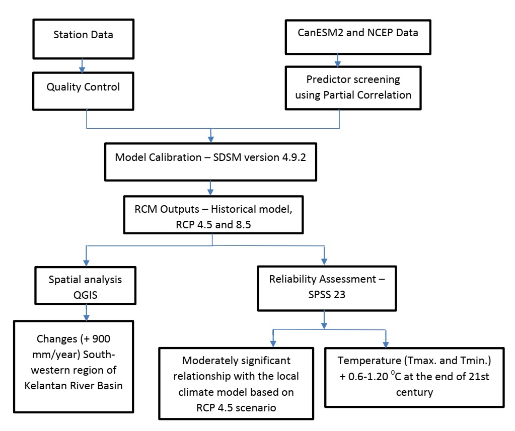
Climate change has been discussed frequently in recent decades, and it has increased the probability of extreme flood occurrence. This study aims to provide an analysis of future rainfall patterns and flood occurrences specifically for the Kelantan River Basin which is identified as one of flood prone areas in Malaysia. The study area was divided into five regions of the Kelantan River Basin, - Kota Bharu (Northern), Kuala Krai (Center), Pos Lebir (Southeastern), Pos Hua (Southwestern) and Pos Gob (Northwestern). The historical rainfall data (1986-2019) was then retrieved from the Malaysian Meteorological Department (MMD) based on the five regions. The statistical approach was applied to downscaled climate model data from the CanESM2 GCM forced by the Representative Concentration Pathway (RCP) 4.5 and 8.5. The reliability assessment using a Cronbach’s Alpha, Linear Regression and Pearson Correlation results show that local climates (2006-2019) forced by RCP4.5 have a similar trend to historical rainfall within the same period. The spatial analysis outcomes showed that the northeastern region of the Kelantan River Basin received its highest average annual rainfall (5,000 mm) in 1990 and caused severe flooding in the area. However, there is a significant change of rainfall pattern in all regions, with a steady increase in annual rainfall in the southwestern region (2021-2100).