You are here
Estimation of changes in the Dead Sea surface water area through multiple water indices and geospatial techniques
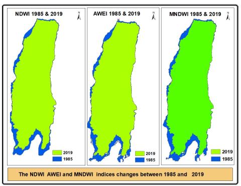
The study calculated the changes in the Dead Sea surface area from 1984 to 2019. The satellite images of 1985, 1990, 2000, 2010, and 2019 were classified by applying four different methods to estimate the changes in the Dead Sea surface water area. The methods included normalized difference water index (NDWI), modified normalized differences water index (MNDWI), automated water extraction Index (AWEI), and ISO cluster unsupervised classification. The results revealed a decrease of 76.63 sq. km area that accounts for an average of 11.27% sea area. The statistical model predicted that the Dead Sea surface area will shrink by half within the next 143 years, and the sea will be completely dried by 2305 if appropriate measures are not taken by decision-makers to avoid further reduction of the surface area.
